🌿Glenwood ArkansasLocal Tourism Guide
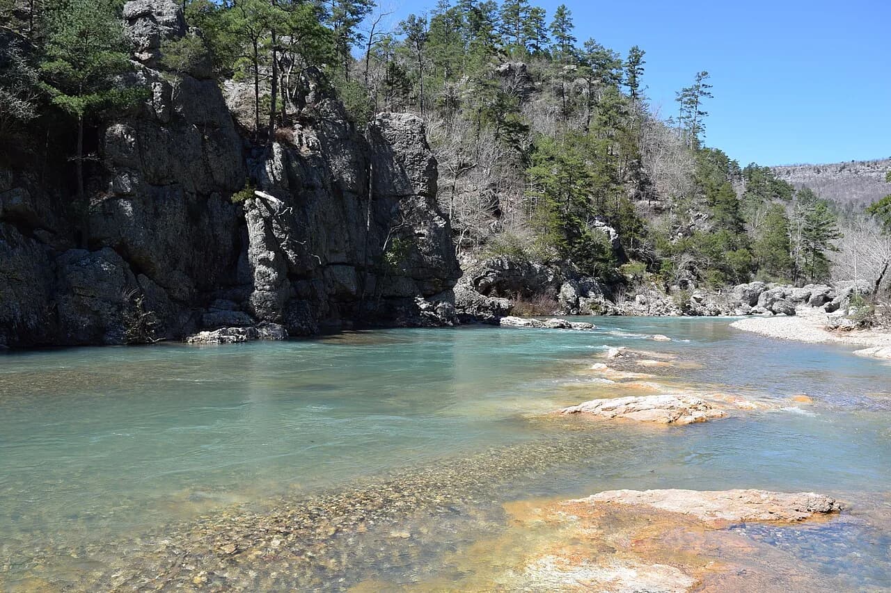
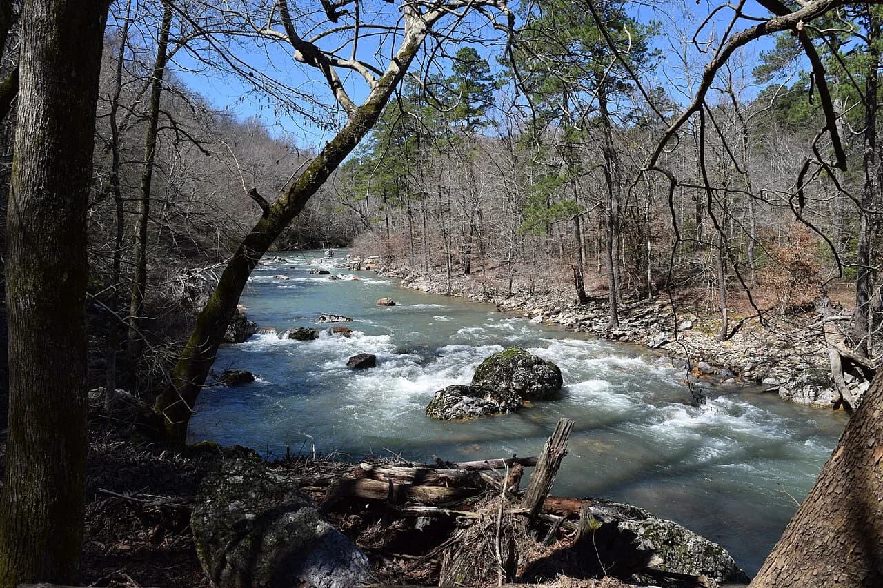
Little Missouri River flowing through the Ouachita National Forest

Collier Springs + Little Missouri Falls

A back-road day trip from Glenwood into the Ouachita National Forest.

Pack lunch, save the route before you lose signal, and leave room for a quiet spring stop, forest roads, a short waterfall walk, and an afternoon beside the Little Missouri River.

Two quiet Ouachita stops worth the drive

Some of the best days around Glenwood begin with a full tank, a cooler, and no reason to hurry.

Collier Springs and Little Missouri Falls sit out in the Ouachita National Forest northwest of Glenwood. Neither is a polished roadside attraction with a gift shop, concession stand, and crowded parking lot. These are simple forest stops reached by winding highways and back roads through the mountains.

Collier Springs gives you a quiet place to sit near a clear-flowing spring. Little Missouri Falls adds a picnic area, a short walk, rocky cascades, and places along the river where you can cool off when conditions are right. Both are close enough to combine into a full-day outing from Glenwood, but far enough into the forest that the drive becomes part of the trip.

This day trip from Glenwood to Little Missouri Falls is a good fit for families, couples, cabin guests, scenic drivers, and locals who want a different kind of outdoor day without committing to a long backpacking trip.
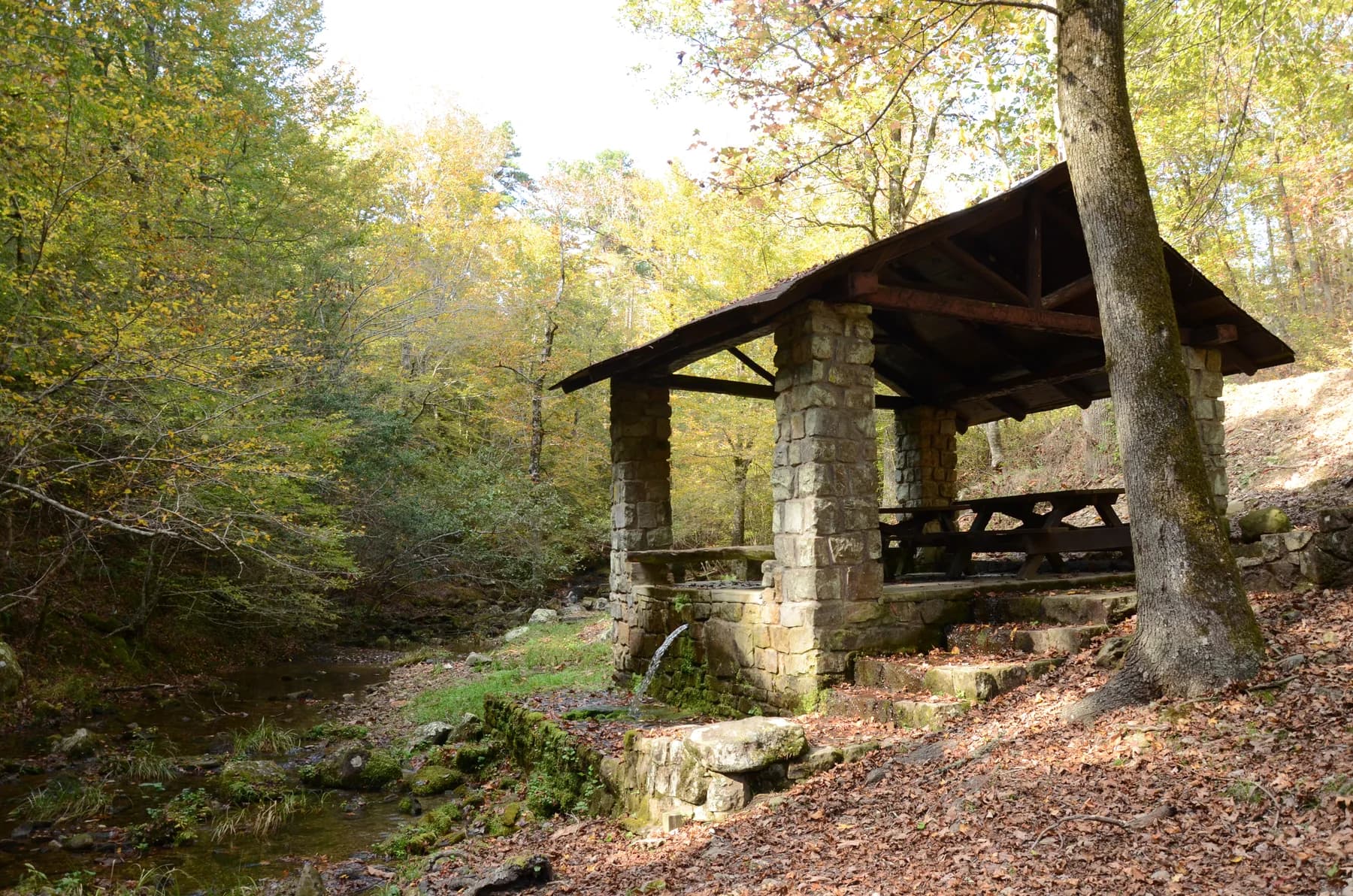
Historic stone and timber picnic shelter at Collier Springs Arkansas

Start the day in Glenwood

Pick up food, water, ice, and anything else you need before you leave town.

There is no potable water at Collier Springs or Little Missouri Falls. Collier Springs does not have restrooms, and the current Forest Service listing for Little Missouri Falls does not promise the kind of facilities you would find at a developed state park. It is better to leave town prepared than assume you will find supplies once you get into the forest.

A simple picnic works well for this trip. Sandwiches, fruit, chips, drinks, and a few towels are easier than trying to plan a full cookout at an unfamiliar recreation area.

Download your directions before leaving the main highway. Forest roads are not the place to discover that your phone has stopped loading the map.

First stop: Collier Springs near Norman

Collier Springs is the quieter stop, and that is the point.

The Forest Service describes it simply as a natural setting around a clear-flowing spring. That is about right. This is not a large recreation complex or a place where you need a long list of activities planned.

Bring lunch or a snack, walk around the spring area, listen to the water, and enjoy being somewhere that still feels removed from town. It works especially well for visitors who like small forest stops that are easy to overlook when they are only following the biggest names on a tourism map.

Collier Springs is currently listed as open all year and free to visit. It is a day-use picnic area with no potable water or restroom, so plan around the lack of facilities.

Getting to Collier Springs

The official Forest Service directions begin in Norman: take Arkansas Highway 27 north for one mile, turn east onto Forest Service Road 177, and continue for roughly three miles. From Glenwood, head toward Norman first, then slow down and watch for Forest Service road numbers once you leave the highway.

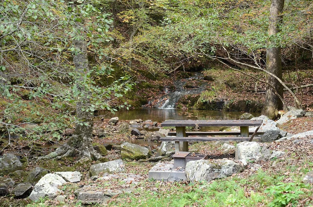
Picnic table, grill, spring, and woods at Collier Springs Arkansas

This is a slow stop, not a packed attraction. Give the spring, shelter, stonework, and surrounding woods a little time.

Little Missouri Falls is the main stop

Save the larger part of the day for the river, picnic area, and short walk toward the cascades.

Little Missouri Falls sits along the upper Little Missouri River in the Ouachita National Forest. Instead of one tall vertical drop, the water moves through a series of rocky cascades and natural pools.

The Forest Service maintains a forested picnic area and a trail leading toward the waterfall overlook. A current trail rehabilitation project describes the access route from the bridge to the overlook as roughly a quarter mile, which makes this a manageable waterfall stop for visitors who do not want a long hike.

That does not mean every part of the area is smooth or easy. Once you move closer to the river, expect rocks, roots, damp ground, and uneven footing. Wear actual walking shoes. Flip-flops may work while sitting near the water, but they are not the best choice for wet rock.

Clear Little Missouri River water and rocky Ouachita Mountain terrain

Take your time around the cascades

This is not a stop that needs to be rushed.

Walk toward the overlook, find a safe place to sit, and watch how the river moves through the rock. Depending on recent rainfall, the cascades may be moving hard or spreading more gently across exposed stone.

The area is used for picnicking, photography, hiking, fishing, and time beside the river. When water is calm, visitors sometimes wade or cool off around the natural pools. Use common sense. This is a real river, and conditions can change after rain.

Keep children close around the water and rocks. Wet stone can be slick even when the river looks calm.

Know where the trail goes

The easy waterfall walk sits near much harder backcountry routes.

Little Missouri Falls is one of the access points for Eagle Rock Loop. That route crosses streams and travels over nine mountains. It is a serious backcountry trail, not an extension of the casual waterfall walk.

Families and casual visitors can stay around the picnic area, access trail, and overlook. Do not continue onto a longer route just because a path heads into the woods unless you know where it leads and are prepared for it.

River and creek crossings can become dangerous during high water. A short stop at the falls does not require taking on those routes.

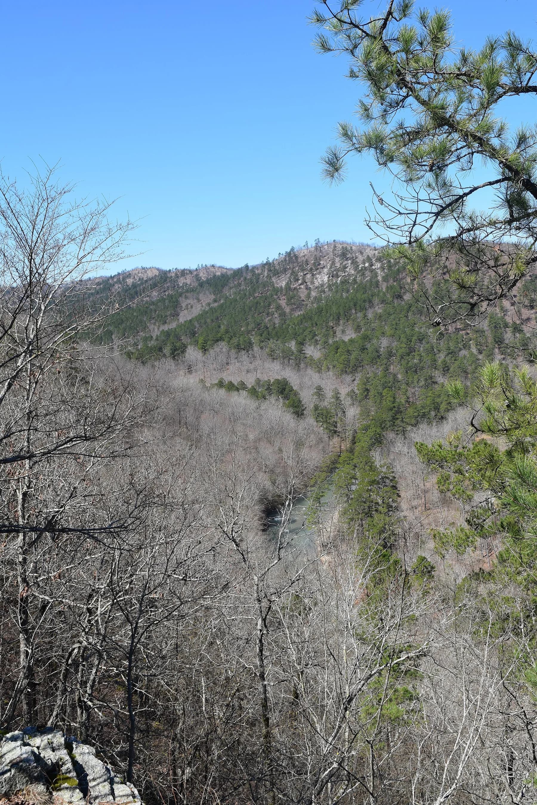
Ouachita Mountains above the Little Missouri River in Arkansas

Getting there from Glenwood

Save the Forest Service road numbers before leaving town.

The official route begins west of Glenwood. Take Arkansas Highway 84 toward Langley, turn north onto Arkansas Highway 369, and continue toward the Forest Service road network that leads to the falls.

The Forest Service directions continue through Forest Service Roads 73, 43, 25, and 539. Road names, surfaces, closures, and navigation conditions can change, so use the current official directions instead of relying on an old social post or a shortcut suggested by a map app.

Write the road numbers down or save a screenshot. After hard rain or severe weather, contact the Caddo-Womble Ranger District at 870-867-2101 for current information before heading deep into the forest.

How to combine both stops

Treat this as a full day in the forest, not a quick hour-long side trip.

Collier Springs and Little Missouri Falls are reached from different forest-road approaches, so this is not the kind of trip where you should blindly follow the shortest line shown on a phone.

A practical plan is to leave Glenwood in the morning with food, water, and a full tank. Head toward Norman and visit Collier Springs while the day is still cool. Return to the paved highway rather than trying an unfamiliar forest-road shortcut, then follow the official route through Langley toward Little Missouri Falls.

Eat lunch around the picnic area, walk toward the cascades, and leave enough daylight for the drive back. You may choose to visit the falls first on a warm weekend, especially if you want to reach the water earlier. The order matters less than giving yourself plenty of time.

What to bring

Pack more than you would for a normal roadside attraction.

There is no water or electricity at either recreation area. Both are currently listed as free, year-round day-use sites, but basic facilities are limited.

Drinking water for everyone
Food and snacks
Shoes with decent traction
Towels and a change of clothes
Bug spray and sunscreen
A basic first-aid kit
A paper map or saved offline directions
Trash bags so everything you carry in comes back out
A portable phone charger

Important day-use rules

Collier Springs and Little Missouri Falls are designated day-use areas. A current Ouachita National Forest order prohibits camping inside these areas and restricts use to daylight hours. Posted closures involving flooding, construction, repairs, or other safety concerns also apply. Do not wait until sunset to begin navigating the forest roads back toward Glenwood.

Best time to go

Every season changes the drive and the water.

Spring

Spring usually brings green woods, cooler walking weather, and a better chance of seeing plenty of water moving through the river. Avoid heading in immediately after hard storms when water and road conditions can change fast.

Summer

Summer works well for picnicking and cooling off near the river, but the woods can still feel hot and humid. Leave earlier, carry extra water, and do not count on finding supplies once you are off the highway.

Fall

Fall may be the best all-around season for the drive. The hardwoods add color to the forest roads, and cooler weather makes the stops easier to enjoy. Water flow will depend on recent rain.

Winter

Both recreation areas are listed as open year-round. Winter can mean fewer people and clearer views through the trees, but cold water, damp rock, and shorter daylight hours make planning more important.

Is this a good family trip?

Yes, as long as the adults are comfortable with forest roads, natural terrain, and moving water.

Collier Springs is the simpler stop. Little Missouri Falls requires a short walk, and the river area itself includes natural rock and uneven ground.

This trip is best for children who enjoy being outside and do not need a playground or organized activity every hour. Let them watch the water, look for interesting rocks and leaves, eat lunch under the trees, and spend some time outdoors without turning the whole day into a schedule.

Keep them close around the river, do not let anyone climb onto wet rock without care, and be willing to change plans if water or weather conditions do not look right.

Finish the day back in Glenwood

Dinner, ice cream, and a quiet cabin feel pretty good after a day on the back roads.

You can build this trip into a longer Glenwood weekend with time on the Caddo River, a round of golf, local shopping, or another drive through the Ouachita foothills.

The main thing is not to pack too much into one day. Collier Springs and Little Missouri Falls work because they give you time to drive, stop, sit, walk, and enjoy a part of Arkansas where the forest still sets the pace.

For visitors looking for a day trip from Glenwood to Little Missouri Falls, adding Collier Springs gives the route another quiet stop and turns a waterfall visit into a better look at the back roads around the Ouachita National Forest.

Frequently asked questions

What to know before heading into the forest

Is Little Missouri Falls close enough for a day trip from Glenwood?

Yes. It is within day-trip range, but the final portion follows slower forest roads. Plan most of the day instead of treating it like a quick roadside stop.

Does it cost anything to visit Collier Springs or Little Missouri Falls?

Both sites are currently listed by the U.S. Forest Service as free day-use recreation areas.

Can you swim at Little Missouri Falls?

Visitors sometimes wade or cool off around the natural pools, but water levels and current can change. Avoid high or fast-moving water and closely supervise children.

Can you camp at Collier Springs or Little Missouri Falls?

Not inside the designated day-use areas. Current Forest Service rules prohibit camping there and restrict use to daytime hours.

Are restrooms and drinking water available?

Collier Springs does not have potable water or restrooms. Little Missouri Falls does not have potable water or electricity, so bring what you need and plan conservatively.

Photo credits

Collier Springs Shelter and Collier Springs upstream photos by Valis55 (Shane Vaughn). Little Missouri River and Ouachita National Forest photos by Fredlyfish4. Images were resized and converted for web use under the Creative Commons Attribution- ShareAlike 4.0 license. View the original files on Wikimedia Commons.